LMNSC Information Page
- Address: 6551 143rd Street West, Lonsdale, MN 55046.
- Lake Mazaska North Shore Cooperative: The LMNSC is a “Not for Profit” organization formed in 2005.
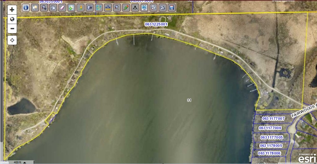
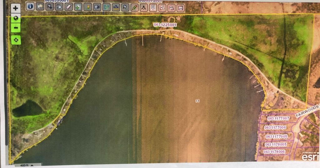
- The Land: The LMNSC consists of 74 acres of land. Much of this land is designated as “wetlands” by Rice County. Please refer to the link provided for a picture that was obtained from the Rice County Beacon website showing the land that comprises the LMNSC. The property ID number for the LMNSC is: 06.31.2.25.001.
- LMNSC Legal Description (use this when submitting permit or variance requests to Rice County):
Government Lot 1, and the West One-half (W ½) of Government Lot 2, in Section 31, Township 111 North, Range 21 West of the Fifth Principal Meridian, Rice County, Minnesota; EXCEPTING THEREFROM THE FOLLOWING PARCEL OF LAND TO-WIT:
All that part of Government Lot 1, Section 31, Township 111 North, Range 21 West of the Fifth Principal Meridian, Rice County, Minnesota: Commencing at the Northwest Corner of Section 31, Township 111 North, Range 21 West; thence south along the West line of Section 31, Township 111 North, Range 21 West, 1184 feet; thence South 81 degrees 36 feet East 667.5 feet to a point, said point being point of beginning; thence South 41 degrees 30 feet West 160.3 feet; thence South 45 degrees 45 feet East approximately 70 feet to Lake Mazaska; thence following along the high water line about 184 feet measured along the lake to a point that is South 67 degrees 23 feet East approximately 60 feet from the place of beginning; thence North 67 degrees 23 feet West approximately 60 feet to the place of beginning; subject to roads, easements, restrictions and agreements and leases of record.
- Shoreline: The LMNSC resides on approximately ½ mile of shore on the north and northwest sides of Lake Mazaska.
- # Cabins on the LMNSC: There are 52 cabins/lots located on the property.
- While most of the cabins are considered “seasonal use”, there are a few cabins that are inhabited year-round by their owners.
- Cabin 47 is not part of the LMNSC. This cabin is registered at Rice County as being its own private piece of land that has an easement to use the LMNSC road.
- Lots in the LMNSC: Each cabin that is part of the LMNSC resides on a piece of land that is considered the responsibility of that cabin owner. The cabin owner is responsible for all maintenance of their lot. The size and boundaries of each lot have been agreed to by the current owners of the cabin and their neighbors.
- Common Ground: All areas that are not considered part of the lot that a cabin resides on are considered “common ground”. The LMNSC Bylaws have guidelines that govern what can and cannot be done on this land. The LMNSC Board provides oversight of the use of the common ground. Below is a rough estimate using highlights of the areas considered to be common ground.
- Annual Meeting: The LMNSC holds an Annual Meeting in September to:
- Elect new Board members
- Share financial status
- Give and receive information/suggestions to members
- Provide committee updates
- Road/Access: The road that services the LMNSC is a private road. This road is maintained by the LMNSC and is kept open throughout the winter.
- Funds: The LMNSC collects annual dues from its members. These funds are used to pay for the following:
- Maintenance of the road and culverts.
- Property taxes for the land
- NOTE: Each cabin owner is responsible to pay for their own property taxes related to the value of their cabin.
- Liability insurance for the common areas of the land.
- NOTE: Each cabin owner is responsible to pay for their own insurance to cover liability and/or loss of property on their lot.
- Other activities/projects approved by the Board or by vote at the annual meeting.
- Annual Picnic: The LMNSC holds an annual picnic in the summer each year to provide an opportunity for cabin owners to reacquaint themselves.